Close your eyes and picture it: the soft rush of the Eagle River, dinner on a sunny patio, and a quick stroll to coffee and a movie without getting in the car. If you love mountain living with real walkability, life along the river in Edwards delivers a rare blend of nature and convenience. In this guide, you’ll learn what daily life feels like near Riverwalk, how trails and river access work, where fly-fishing fits in, and what to know if you are considering a home close to the water. Let’s dive in.
Why Riverwalk in Edwards shines
Edwards is the mid-valley hub for Eagle County, with roughly 11,000 to 11,300 residents. Riverwalk anchors the community’s daily rhythm as a compact, mixed-use village on the Eagle River. It brings together restaurants, boutiques, a movie theatre, and lodging in one walkable footprint. You can preview the district on the official Riverwalk at Edwards site.
You are well positioned for four-season fun. Beaver Creek is a short drive to the east, with Vail a bit farther. Planning materials also note practical travel details: about a 2.5-hour drive to Denver International Airport, and roughly 20 to 30 miles to the Eagle County Regional Airport to the west. Major routes like I-70 and US-6 shape local access and, in some areas, noise patterns. For a deeper look at routes, crossings, and travel context, the Edwards Transportation Master Plan is a helpful reference.
Daily life on the river
Walk-to-everything convenience
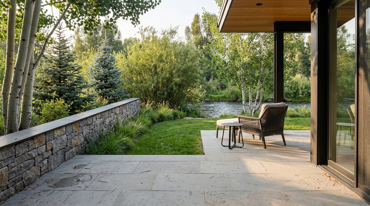
Riverwalk’s footprint is intentionally compact, so many businesses sit steps from the riverbank and the paved trail. Several residences are above or next to retail, which means dinner, errands, and entertainment are a short walk away. In summer, patio dining along the water is a true local favorite. Explore seasonal al fresco spots highlighted by the Inn at Riverwalk.
Trails and easy strolls
The Eagle Valley multi-use trail system, often called the ECO Trail, parallels US-6 through Edwards and connects neighborhoods across the valley. Through Edwards, the paved path crosses the Eagle River in several places and links to spur trails. The network is largely continuous, though the Master Plan notes a few local gaps and crossings to navigate. You can review the routing and planned improvements in the Transportation Master Plan.
Respectful river access
Public river access here is both special and specific. Several designated entry points and State Wildlife Area parcels provide opportunities for fishing and river viewing. Avoid stepping onto private banks or creating new footpaths. The Colorado Parks and Wildlife map shows where public access is allowed and notes rules that may apply. Stewardship groups are also working to manage high-use areas and erosion near Riverwalk, which you can see in project updates from the Eagle River Coalition.
Fly-fishing and river fun
The Edwards stretch of the Eagle River is well known for trout fly-fishing, with brown and rainbow trout common. Local outfitters share seasonal reports on hatches and flows. For an overview of the Eagle River fishery and timing, browse insights from Vail Valley Anglers.
If you plan to wade or fish, keep it simple and considerate. Use public access points and follow CPW rules that may include gear or seasonal limits. Respect private property signage. If you are unsure about access, consult CPW resources or check in with a reputable local outfitter before you go.
Homes near the water
What you can buy
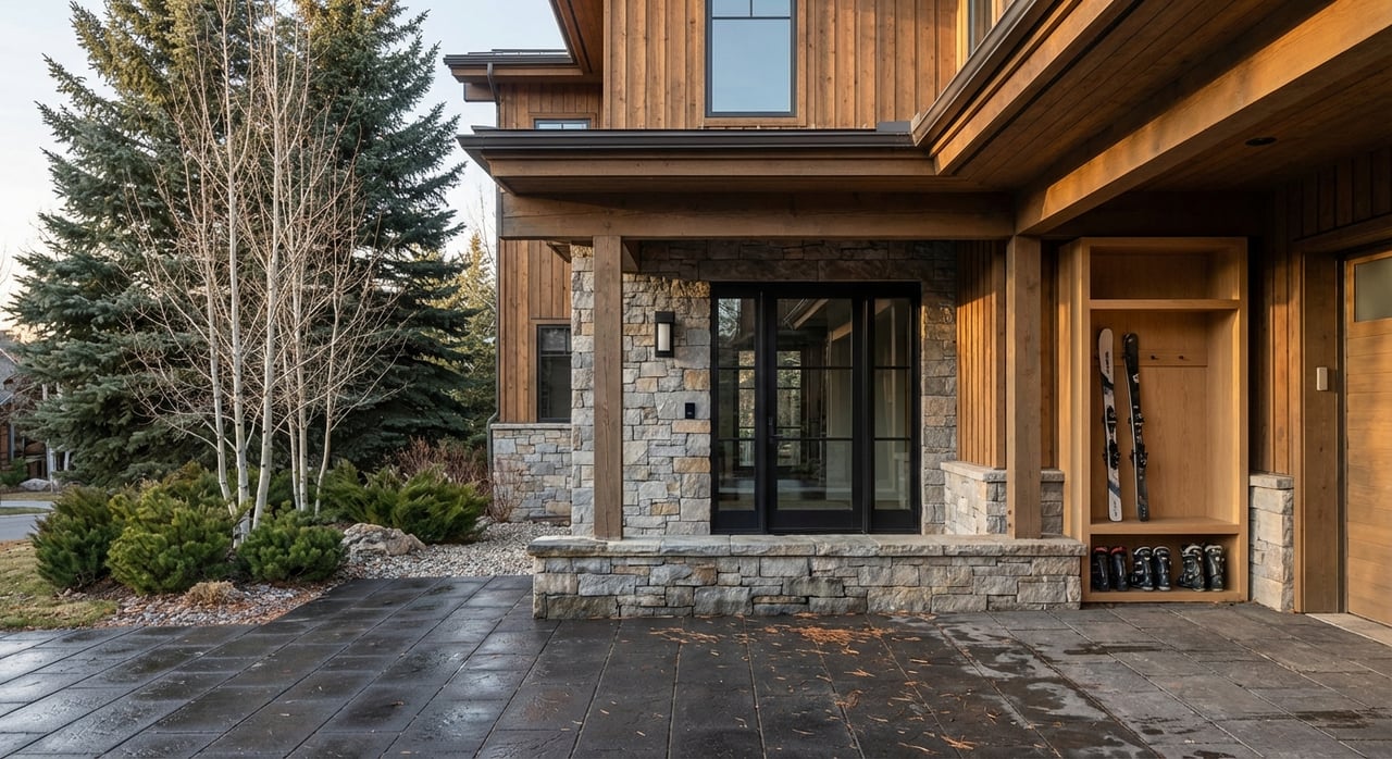
Within walking distance of Riverwalk, you will primarily find mixed-use condominiums located above or near retail, as well as purpose-built condo and townhome communities. Single-family neighborhoods sit a short drive away, and the broader Edwards planning area also includes private planned communities and purpose-built workforce neighborhoods. The Transportation Master Plan describes local densities, connections, and neighborhood context.
Market snapshot, the smart way
Resort markets shift quickly, and different data sources can show very different “median” figures at any given time. Instead of anchoring to a single number, assess value by property type, river proximity, view corridors, condition, and HOA strength. A current, property-specific analysis is the best way to understand pricing and timing.
River-specific due diligence
Buying close to the water adds a few smart steps to your checklist:
- Confirm floodplain status. Review FEMA maps for the parcel and ask for elevation certificates and any past floodplain permits. Start with FEMA’s Flood Map Service Center.
- Ask about bank stabilization and riparian maintenance. Many river-edge owners and HOAs coordinate with nonprofits and county partners on restoration. Project materials near Riverwalk are summarized by the Eagle River Coalition.
- Review HOA rules related to riverbank access and any private improvements. Understand how the association manages trails, vegetation, and seasonal use.
- Consider workforce or deed-restricted housing in your search if it fits your goals. Eagle County actively pursues programs and projects that add deed-restricted inventory. For background on the valley’s housing mix, see this overview from the Vail Daily.
- Know your utilities and long-term water planning. Regional water and sanitation services are provided by entities such as Eagle River Water & Sanitation District and the Upper Eagle Regional Water Authority. You can see an example of ongoing planning in ERWSD’s Bolts Lake evaluation.
Seasons on the Eagle River
Summer
Warm days draw you outside for river viewing, easy wading at public sections, and patios that hum with conversation. You will also see prolific aquatic insect hatches like caddis and PMDs in late spring and early summer, which make for exciting dry-fly moments. The Inn at Riverwalk’s al fresco primer captures the season’s relaxed vibe.
Fall and winter
As flows drop in fall, streamer fishing can shine and trails feel quieter. Winter brings world-class skiing close to home, with Beaver Creek the nearest resort drive and Vail within regional reach. Snow management and traffic follow familiar valley patterns that are outlined in the Transportation Master Plan.
Buying along the river with confidence
Use this quick checklist as you tour:
- Verify FEMA flood zone, elevation certificate, and any county floodplain permits.
- Review HOA documents on riverbank use, restoration responsibilities, insurance, and reserves.
- Ask about bank stabilization history, recent repairs, and future plans.
- Understand trail proximity, river views, and any planned crossing improvements.
- Test the walk from your door to dining, errands, and transit stops.
- Note road proximity and sound at different times of day.
- Confirm parking, bike and gear storage, and snow-removal practices.
- Get a current, property-specific pricing analysis before making an offer.
When you are ready to explore, you deserve an advisor who knows the river, the trails, and the nuances that matter. For 30-plus years, Doug Landin has helped clients buy and sell in the Vail Valley with a hands-on, local-first approach backed by global reach. Let’s connect to align your lifestyle goals with the right property.
FAQs
Can you fish from your Edwards riverfront yard?
- Not automatically. In Colorado, public use is limited to designated access points and State Wildlife Areas. Always check the CPW access map and obey posted signage.
Are Edwards riverfront homes in the floodplain?
- Many river-edge parcels are in or near FEMA-mapped zones. Confirm the parcel on FEMA’s Flood Map Service Center and ask the seller about elevation certificates and any floodplain permits.
How walkable is Riverwalk to daily needs in Edwards?
- Riverwalk was designed as a compact, mixed-use hub with restaurants, shops, a grocer, and a movie theatre, plus paved trail connections. Preview the district at Riverwalk at Edwards.
What should you ask about a river-edge condo’s HOA?
- Ask about flood status, elevation certificates, riverbank stabilization history, restoration plans, and rules on private access or improvements. Eagle County’s Engineering Criteria Manual outlines permit procedures for floodplain work.
How far is Edwards from airports and ski areas?
- Plan on about a 2.5-hour drive to Denver International Airport, roughly 20 to 30 miles to Eagle County Regional Airport, Beaver Creek a short drive east, and Vail farther east. See the Transportation Master Plan for travel context and routes.